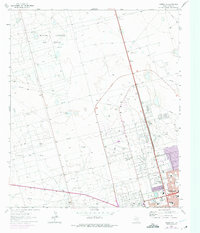
1964 Map of Odessa NW
USGS Topo · Published 1975About this map
The North Cowden Oil Field, Johnson Oil Field, and Foster Oil Field dominate this West Texas landscape, illustrating the industrial pulse of Ector Co during the mid-1960s. The map reveals an intricate network of pipelines and aqueducts that service these petroleum fields, interspersed with scattered landmarks like Mexican Well and West Windmill.
Find a feature on this map
43 named features on this map. Tap any name to fly to it.
Don’t see what you’re looking for? This feature index may not catch every label — zoom into the map to look around manually.
Map Details
Editions of this 1964 Odessa NW Map
4 editions found
Other maps of this area

1954 · Hobbs
USGS Topo · 1:250,000

1954 · Pecos
USGS Topo · 1:250,000

1957 · Pecos
USGS Topo · 1:250,000

1958 · Hobbs
USGS Topo · 1:250,000

1964 · Odessa NE
USGS Topo · 1:24,000

1964 · Odessa SW
USGS Topo · 1:24,000

1964 · Odessa NW
USGS Topo · 1:24,000

1964 · Odessa SE
USGS Topo · 1:24,000

1964 · Douro
USGS Topo · 1:24,000

1965 · Goldsmith
USGS Topo · 1:24,000