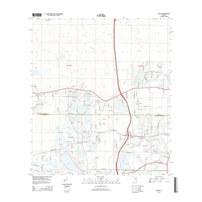
2015 Map of Odessa
USGS Topo · Published 2015About this map
Odessa and Lake Fern sit at the heart of this landscape along the border of PasCO and Hillsborough counties, where the headwaters of the Anclote River emerge from a dense collection of lakes. The area's character is defined by its hydrology, with larger bodies like Island Ford Lake, Keystone Lake, and Crescent Lake punctuating the residential development expanding along SR-54 and Old Gunn Hwy. A complex network of smaller basins, including Lake Minniola, Lake Geneva, and Lake Hiawatha, illustrates the intricate drainage patterns that have historically shaped local settlement and land use. The presence of the Terrain DC Golf Dr and numerous residential winding drives like Wadsworth Dr and Wyndham Lakes Dr reflects the modern transformation of this once-rural lake country into a suburban corridor, while the S Br Anclote River continues to mark the natural terrain.
Find a feature on this map
156 named features on this map. Tap any name to fly to it.
Don’t see what you’re looking for? This feature index may not catch every label — zoom into the map to look around manually.
Map Details
Editions of this 2015 Odessa Map
This is the sole edition of this map. No revisions or reprints were ever made.
Other maps of this area

1943 · Odessa
USGS Topo · 1:24,000

1943 · Elfers
USGS Topo · 1:24,000

1943 · Lutz
USGS Topo · 1:24,000

1943 · Oldsmar
USGS Topo · 1:24,000

1944 · Sulphur Springs
USGS Topo · 1:31,680

1944 · Elfers
USGS Topo · 1:31,680

1944 · Lutz
USGS Topo · 1:31,680

1944 · Oldsmar
USGS Topo · 1:31,680

1944 · Odessa
USGS Topo · 1:31,680

1945 · Sulphur Springs
USGS Topo · 1:31,680