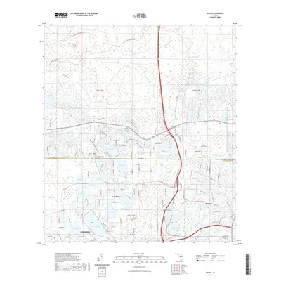
2021 Map of Odessa
USGS Topo · Published 2021About this map
The Odessa region and the northern reaches of Keystone are defined by an intricate network of cypress-fringed lakes and wetlands along the Pasco-Hillsborough county line. This landscape is centered on the headwaters of the Anclote River and its various tributaries like Sandy Br and Cross Cypress Br. The settlement pattern reflects a mixture of historic lakeside communities and modern developments, with established nodes at Lake Fern and Gulf Pine.
Find a feature on this map
51 named features on this map. Tap any name to fly to it.
Don’t see what you’re looking for? This feature index may not catch every label — zoom into the map to look around manually.
Map Details
Editions of this 2021 Odessa Map
This is the sole edition of this map. No revisions or reprints were ever made.
Other maps of this area

1943 · Odessa
USGS Topo · 1:24,000

1943 · Elfers
USGS Topo · 1:24,000

1943 · Lutz
USGS Topo · 1:24,000

1943 · Oldsmar
USGS Topo · 1:24,000

1944 · Sulphur Springs
USGS Topo · 1:31,680

1944 · Elfers
USGS Topo · 1:31,680

1944 · Lutz
USGS Topo · 1:31,680

1944 · Oldsmar
USGS Topo · 1:31,680

1944 · Odessa
USGS Topo · 1:31,680

1945 · Sulphur Springs
USGS Topo · 1:31,680