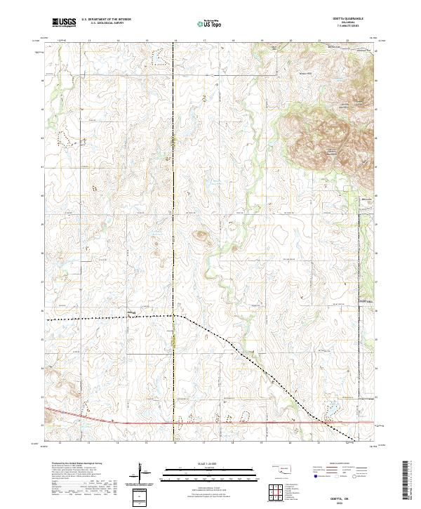
2022 Map of Odetta
USGS Topo · Published 2022About this map
The Wichita Mountains dominate the northeastern landscape of this region, where the Kiowa Co Comanche Co line divides the rolling plains. The settlement of Odetta sits as a central point of reference within a network of section-line roads like E1620 Rd and NW 277th St. Notable elevations include the rugged Charons Garden Mountains and Sunset Peak, providing a stark contrast to the nearby drainage of Deep Red Cr and Little Post Oak Cr. Several modern reservoirs, such as 075014 Reservoir and 031017 Reservoir, highlight the managed water resources of the modern era. Smaller landmarks like Cottonwood Spring and the Broken Hills suggest the traditional water sources and natural barriers that shaped the early cattle and ranching history of Southwest Oklahoma.
Find a feature on this map
46 named features on this map. Tap any name to fly to it.
Don’t see what you’re looking for? This feature index may not catch every label — zoom into the map to look around manually.
Map Details
Editions of this 2022 Odetta Map
This is the sole edition of this map. No revisions or reprints were ever made.
Other maps of this area

1937 · Cache
USGS Topo · 1:48,000

1937 · Quanah Mountain
USGS Topo · 1:24,000

1942 · Cache
USGS Topo · 1:62,500

1949 · Cooperton
USGS Topo · 1:62,500

1949 · Quanah Mountain
USGS Topo · 1:24,000

1950 · Snyder
USGS Topo · 1:62,500

1950 · Saddle Mountain
USGS Topo · 1:62,500

1955 · Lawton
USGS Topo · 1:250,000

1956 · Post Oak Creek
USGS Topo · 1:24,000

1956 · Glen Mountains
USGS Topo · 1:24,000