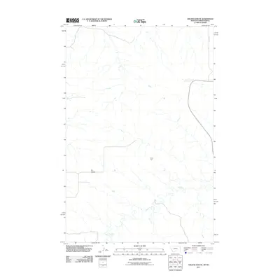
2011 Map of Odland Dam NE
USGS Topo · Published 2011About this map
Blue Mountain Cemetery serves as a primary local landmark in this sparsely populated stretch of Golden Valley County. The landscape is defined by the winding course of Beaver Creek, which is fed by Dry Creek as it moves across the prairie terrain. Human intervention in the local water system is marked by the presence of Hollar Dam, a small-scale structure likely tied to livestock or local irrigation needs. Transportation in this corner of North Dakota is limited to a grid of section-line roads, including Vinquist Rd, which provides access to the ranching and agricultural lands that dominate the region. This 2011 survey illustrates the late-twentieth and early twenty-first-century rural layout, where vast distances are punctuated only by essential water management features and small family burial sites.
Find a feature on this map
5 named features on this map. Tap any name to fly to it.
Don’t see what you’re looking for? This feature index may not catch every label — zoom into the map to look around manually.
Map Details
Editions of this 2011 Odland Dam NE Map
This is the sole edition of this map. No revisions or reprints were ever made.
Other maps of this area

1909 · Glendive
USGS Topo · 1:250,000

1953 · Watford City
USGS Topo · 1:250,000

1954 · Glendive
USGS Topo · 1:250,000

1957 · Glendive
USGS Topo · 1:250,000

1957 · Watford City
USGS Topo · 1:250,000

1958 · Glendive
USGS Topo · 1:250,000

1967 · Watford City
USGS Topo · 1:250,000

1974 · Hootowl Creek West
USGS Topo · 1:24,000

1974 · Trotters
USGS Topo · 1:24,000
1974 · Skaar
USGS Topo · 1:24,000