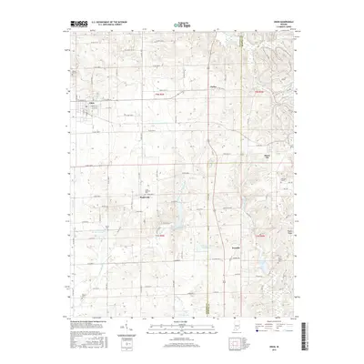
2016 Map of Odon
USGS Topo · Published 2016About this map
Odon stands as the primary settlement in this southwestern Indiana landscape, where the grid of Daviess County roads meets the more varied terrain of the Martin County line to the east. The area is characterized by a series of small agricultural communities and family landmarks, including Raglesville, Bramble, and Farlen. The map reveals a complex water management system along the North Fork Prairie Creek, noted by several infrastructure markers such as Prairie Cr Structure Number A-3-2 and the Prairie Cr Dam Number A-3-1. This network of creeks, including Seed Tick Cr and W Boggs Cr, flows through a region deeply rooted in local history, as evidenced by numerous scattered burial grounds like Walnut Hill Cem and Saint Joseph Cem. The eastern edge rises toward Pigeon Ridge, marking a shift from the flat prairie lands into more dissected uplands.
Find a feature on this map
81 named features on this map. Tap any name to fly to it.
Don’t see what you’re looking for? This feature index may not catch every label — zoom into the map to look around manually.
Map Details
Editions of this 2016 Odon Map
This is the sole edition of this map. No revisions or reprints were ever made.
Other maps of this area
1943 · Lyons
USGS Topo · 1:24,000
1943 · Epsom
USGS Topo · 1:24,000
1944 · Montgomery
USGS Topo · 1:24,000
1950 · Shoals
USGS Topo · 1:24,000
1950 · Odon
USGS Topo · 1:24,000
1956 · Loogootee
USGS Topo · 1:24,000
1956 · Koleen
USGS Topo · 1:24,000
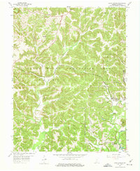
1956 · Indian Springs
USGS Topo · 1:24,000
1956 · Vincennes
USGS Topo · 1:250,000
1957 · Vincennes
USGS Topo · 1:250,000