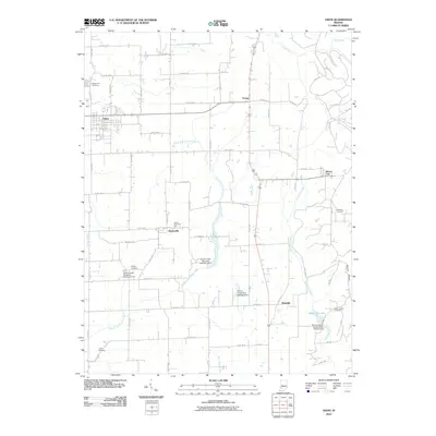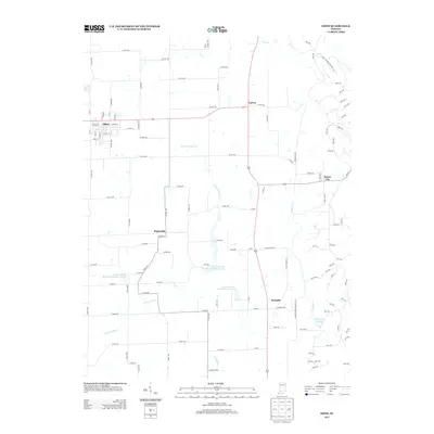
2022 Map of Odon
USGS Topo · Published 2022About this map
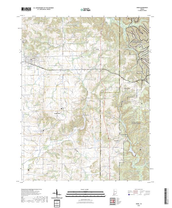
Odon serves as the primary hub in this portion of northern Daviess County, where a rigid grid of county roads meets the more fluid terrain of the eastern uplands. The landscape transitions from the relatively flat farmland surrounding Farlen and Raglesville to the dissected hills of Pigeon Ridge near the Martin County line. Water management is a visible priority in the geography, evidenced by features such as Prairie Cr Dam Number A-3-1 and Prairie Cr Structure Number A-3-2. Small, established communities like Burns City and Bramble anchor the eastern half of the map, connected by winding routes like Raglesville Rd and Bramble Rd. Family and community history is preserved in numerous burial grounds, including Walnut Hill Cem and Saint Joseph Cem, which are scattered throughout the rural landscape, often situated near historic property lines and early township boundaries.
Find a feature on this map
102 named features on this map. Tap any name to fly to it.
Don’t see what you’re looking for? This feature index may not catch every label — zoom into the map to look around manually.
Map Details
Editions of this 2022 Odon Map
This is the sole edition of this map. No revisions or reprints were ever made.
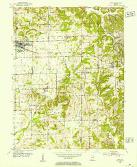
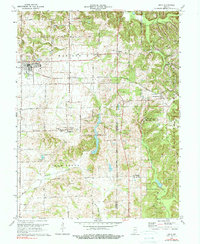
Historical Maps of Odon Through Time
7 maps found