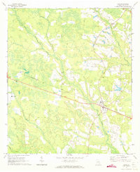
1971 Map of Odum
USGS Topo · Published 1973About this map
The coastal plain of Wayne County, Georgia, is defined here by the winding course of Little Satilla Creek and its many tributaries, including Goose Creek and Keene Bay Branch. This 1971 survey captures the town of Odum at the intersection of local roads and the Southern railway line, which cuts a straight path through the heavily forested and marshy landscape. Small rural clusters like Brentwood, Ross, and Tetlow punctuate the landscape, reflecting a pattern of settlement closely tied to the railroad and the timber-rich surroundings.
Find a feature on this map
16 named features on this map. Tap any name to fly to it.
Don’t see what you’re looking for? This feature index may not catch every label — zoom into the map to look around manually.
Map Details
Editions of this 1971 Odum Map
2 editions found
Other maps of this area

1918 · Jesup
USGS Topo · 1:62,500

1920 · Glennville
USGS Topo · 1:62,500

1943 · Jesup
USGS Topo · 1:62,500

1944 · Glennville
USGS Topo · 1:62,500

1946 · Brunswick
USGS Topo · 1:250,000

1948 · Brunswick
USGS Topo · 1:250,000

1950 · Glennville
USGS Topo · 1:62,500

1953 · Waycross
USGS Topo · 1:250,000

1956 · Brunswick
USGS Topo · 1:250,000

1958 · Waycross
USGS Topo · 1:250,000