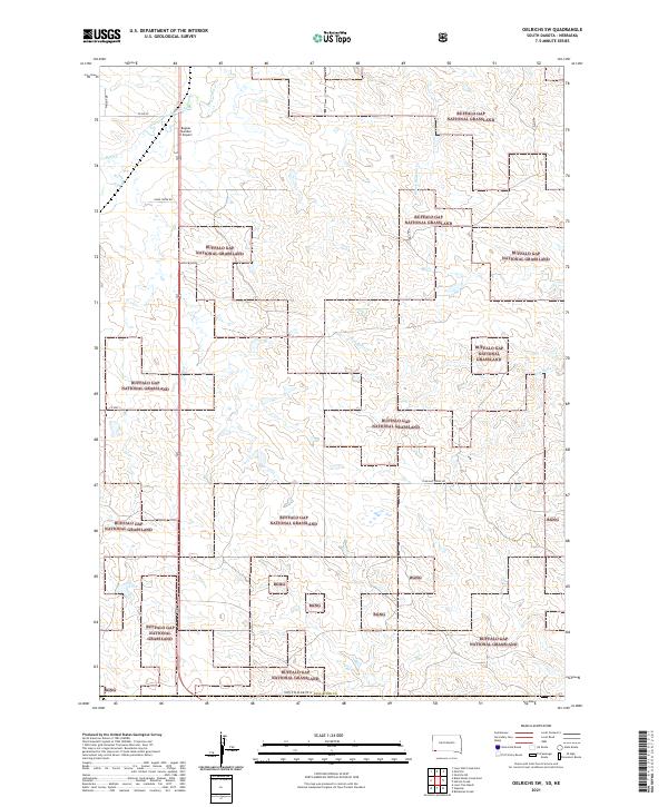
2021 Map of Oelrichs SW
USGS Topo · Published 2021About this map
Buffalo Gap National Grassland dominates this portion of Fall River County, where the topography is defined by the drainage basins of Horsehead Creek and Slim Butte Cr. The map reveals a landscape of expansive public lands interspersed with private sections, primarily used for cattle ranching and aviation. The Bogner Number II Airport serves as a lone localized hub for transit in an area otherwise characterized by intermittent watercourses like Beef Cr and S Fork Blacktail Cr. A sparse network of county and ranch roads, including Wright Dr and Shirk Creek Rd, provides the only terrestrial access across the varied terrain. This survey provides an essential view of South Dakota's open-range character, showing how property lines and grazing boundaries are etched into the high plains landscape.
Find a feature on this map
17 named features on this map. Tap any name to fly to it.
Don’t see what you’re looking for? This feature index may not catch every label — zoom into the map to look around manually.
Map Details
Editions of this 2021 Oelrichs SW Map
This is the sole edition of this map. No revisions or reprints were ever made.
Other maps of this area

1896 · Oelrichs
USGS Topo · 1:125,000

1900 · Oelrichs
USGS Topo · 1:125,000

1955 · Hot Springs
USGS Topo · 1:250,000

1955 · Alliance
USGS Topo · 1:250,000

1957 · Alliance
USGS Topo · 1:250,000

1958 · Alliance
USGS Topo · 1:250,000
1970 · Bohemian Creek
USGS Topo · 1:24,000

1980 · Lone Tree Ranch
USGS Topo · 1:24,000

1980 · Wayside
USGS Topo · 1:24,000
1982 · Oelrichs SW
USGS Topo · 1:25,000