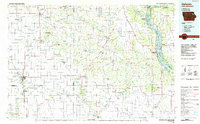
1984 Map of Oelwein
USGS Topo · Published 1985About this map
Turkey River and Volga River valleys dominate this northeastern Iowa landscape, where high bluffs and deep-cut stream channels create a complex network of waterways during the mid-1980s. The region is marked by a high density of conservation lands and state preserves, including the Effigy Mounds National Monument and the dense forests of White Pine Hollow State Park. Significant infrastructure like the Chicago and North Western railroad connects major hubs such as Oelwein and West Union to the surrounding agricultural plains. Local history is anchored by rural landmarks like the St Sebald Ch and historical water features like Quaker Mill Pond. From the Wapsipinicon River in the southwest to the Mississippi River boundary in the east, this survey captures the transition from open prairie settlements like Strawberry Point to the dramatic relief of Chicken Ridge and Military Ridge.
Find a feature on this map
132 named features on this map. Tap any name to fly to it.
Don’t see what you’re looking for? This feature index may not catch every label — zoom into the map to look around manually.
Map Details
Editions of this 1984 Oelwein Map
2 editions found
Other maps of this area

1900 · Anamosa
USGS Topo · 1:125,000

1900 · Lancaster
USGS Topo · 1:125,000

1901 · Peosta
USGS Topo · 1:125,000

1901 · Oelwein
USGS Topo · 1:125,000

1902 · Elkader
USGS Topo · 1:125,000

1903 · Waukon
USGS Topo · 1:125,000

1903 · Winthrop
USGS Topo · 1:125,000

1904 · Lancaster
USGS Topo · 1:125,000

1906 · Decorah
USGS Topo · 1:125,000

1908 · Lancaster
USGS Topo · 1:125,000