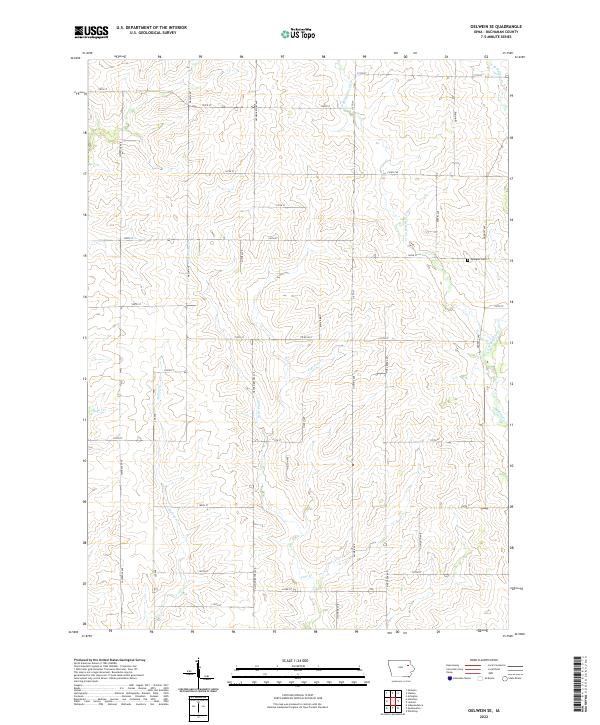
2022 Map of Oelwein SE
USGS Topo · Published 2022About this map
The rolling plains of Buchanan County are defined here by an intricate drainage system that feeds the larger Wapsipinicon River basin. Watercourses like Malone Cr and the various branches of Buffalo Cr and Pine Cr carve gentle valleys through the agrarian landscape, dictating the placement of the rural road grid. The map reveals a highly structured section-line road network, where names like Nathen Bethel Ave, O'Connor Ave, and Plymouth Ave honor the families and lineages of this farming community.
Find a feature on this map
46 named features on this map. Tap any name to fly to it.
Don’t see what you’re looking for? This feature index may not catch every label — zoom into the map to look around manually.
Map Details
Editions of this 2022 Oelwein SE Map
This is the sole edition of this map. No revisions or reprints were ever made.
Other maps of this area

1901 · Oelwein
USGS Topo · 1:125,000

1903 · Winthrop
USGS Topo · 1:125,000

1959 · Dubuque
USGS Topo · 1:250,000

1961 · Dubuque
USGS Topo · 1:250,000

1962 · Dubuque
USGS Topo · 1:250,000

1965 · Arlington
USGS Topo · 1:24,000

1965 · Lamont
USGS Topo · 1:24,000
1973 · Independence
USGS Topo · 1:24,000
1973 · Quasqueton
USGS Topo · 1:24,000
1973 · Winthrop
USGS Topo · 1:24,000