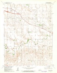
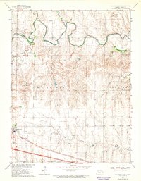
1961 Map of Ogallah
USGS Topo · Published 1962About this map
Ogallah and the surrounding Trego County plains are defined by the path of the Union Pacific railroad and a productive energy landscape in the early 1960s. The settlement pattern follows the rail line and the wandering course of Big Creek, where a Gaging Sta monitors the water flow. The expansive Ogallah Oil Field is marked by numerous oil wells across the northern section of the map, illustrating the importance of petroleum to the local economy alongside traditional farming.
Find a feature on this map
16 named features on this map. Tap any name to fly to it.
Don’t see what you’re looking for? This feature index may not catch every label — zoom into the map to look around manually.
Map Details
Editions of this 1961 Ogallah Map
2 editions found
Other maps of this area

1893 · Ellis
USGS Topo · 1:125,000

1893 · Hill
USGS Topo · 1:125,000

1955 · Great Bend
USGS Topo · 1:250,000

1955 · Beloit
USGS Topo · 1:250,000

1957 · Great Bend
USGS Topo · 1:250,000

1958 · Great Bend
USGS Topo · 1:250,000

1959 · Beloit
USGS Topo · 1:250,000
1960 · Trego Center NE
USGS Topo · 1:24,000
1961 · Ellis
USGS Topo · 1:24,000
1962 · Wa Keeney East
USGS Topo · 1:24,000