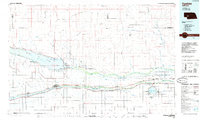
1985 Map of Ogallala
USGS Topo · Published 1985About this map
The waters of the North Platte River and the South Platte River define this 1985 landscape, dominated by the massive impoundment behind Kingsley Dam. The reservoir, Lake Mc Conaughy, reshaped the region's geography, submerging old bottomlands and creating a center for the Lake Mc Conaughy State Recreation Area. To the south, the Union Pacific railroad and Interstate 80 parallel the South Platte, connecting a string of agricultural settlements including Brule, Ogallala, and Paxton. The map illustrates a complex network of mid-century water management, featuring the Sutherland Supply Canal and Western Canal which divert river water toward the Sutherland Reservoir. Smaller rural communities like Lemoyne and Keystone sit near the northern shores, while rugged terrain such as Eagle Canyon and Wildhorse Valley cuts through the surrounding plains.
Find a feature on this map
77 named features on this map. Tap any name to fly to it.
Don’t see what you’re looking for? This feature index may not catch every label — zoom into the map to look around manually.
Map Details
Editions of this 1985 Ogallala Map
2 editions found
Other maps of this area

1897 · Ogallala
USGS Topo · 1:125,000

1898 · Paxton
USGS Topo · 1:125,000

1899 · North Platte
USGS Topo · 1:125,000

1900 · Chappell
USGS Topo · 1:125,000

1900 · Ogallala
USGS Topo · 1:125,000

1901 · Paxton
USGS Topo · 1:125,000

1902 · North Platte
USGS Topo · 1:125,000

1949 · Arthur
USGS Topo · 1:62,500

1949 · Flats
USGS Topo · 1:62,500

1949 · Rackett
USGS Topo · 1:62,500