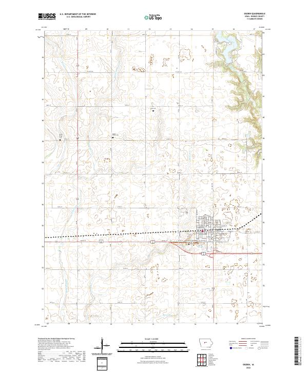
2022 Map of Ogden
USGS Topo · Published 2022About this map
The town of Ogden serves as the central hub of this Boone County landscape, situated at the junction of US Highway 30 and State Highway 169. The urban grid of the town is detailed with a network of local streets such as W Walnut St and E Division St, while the Union Pacific RR provides a critical industrial connection through the heart of the community. Beyond the town limits, the topography is defined by the valley of Bluff Creek and the notable elevation of Fraser Hill, offering a clear view of how the natural drainage systems shaped early settlement patterns and transport routes in central Iowa.
Find a feature on this map
12 named features on this map. Tap any name to fly to it.
Don’t see what you’re looking for? This feature index may not catch every label — zoom into the map to look around manually.
Map Details
Editions of this 2022 Ogden Map
This is the sole edition of this map. No revisions or reprints were ever made.
Other maps of this area

1911 · Madrid
USGS Topo · 1:62,500

1914 · Madrid
USGS Topo · 1:62,500

1916 · Boone
USGS Topo · 1:62,500

1950 · Perry
USGS Topo · 1:62,500

1951 · Perry
USGS Topo · 1:62,500

1951 · Ogden
USGS Topo · 1:62,500

1954 · Omaha
USGS Topo · 1:250,000

1954 · Waterloo
USGS Topo · 1:250,000

1954 · Fort Dodge
USGS Topo · 1:250,000

1954 · Des Moines
USGS Topo · 1:250,000