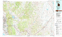
1986 Map of Ogden
USGS Topo · Published 1987About this map
The Wasatch Range forms a towering backdrop for the urban expansion of Ogden and its neighbors in the mid-1980s. This survey illustrates the dense corridor along the Great Salt Lake shoreline, where residential growth from North Ogden down to Kaysville is balanced against significant military and educational footprints at Hill Air Force Base and Weber State College. The map captures a complex transportation hub where the Union Pacific and Denver and Rio Grande Western railroads intersect with major arteries like Interstate 15. Beyond the urban front, the landscape shifts to the high-country basins and canyons of the Wasatch National Forest and Cache National Forest, showing vital water management at Pineview Reservoir and Echo Reservoir. This era represents a period of maturing infrastructure, connecting established mountain settlements like Huntsville and Morgan to the burgeoning valley through the Weber River and Ogden River corridors.
Find a feature on this map
83 named features on this map. Tap any name to fly to it.
Don’t see what you’re looking for? This feature index may not catch every label — zoom into the map to look around manually.
Map Details
Editions of this 1986 Ogden Map
This is the sole edition of this map. No revisions or reprints were ever made.
Other maps of this area

1885 · Salt Lake
USGS Topo · 1:250,000

1885 · Uinta
USGS Topo · 1:250,000

1885 · Tooele Valley
USGS Topo · 1:250,000

1900 · Coalville
USGS Topo · 1:125,000

1901 · Hayden Peak
USGS Topo · 1:125,000

1903 · Hayden Peak
USGS Topo · 1:125,000

1903 · Coalville
USGS Topo · 1:125,000

1912 · Randolph
USGS Topo · 1:125,000

1914 · Logan
USGS Topo · 1:125,000

1916 · Logan
USGS Topo · 1:125,000