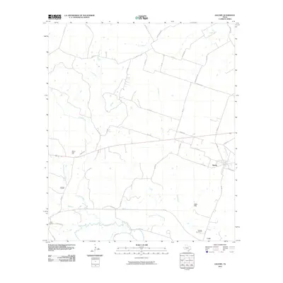
2010 Map of Oglesby
USGS Topo · Published 2010About this map
Oglesby serves as the primary hub of this Central Texas landscape, situated at the crossroads of FM 1996 and local ranch roads. The geography is defined by a dense network of waterways feeding into the Leon River at the southern boundary, including the meandering paths of Coryell Creek and Pew Branch. This area preserves several significant genealogical sites, notably Blackfoot Cemetery and Post Oak Cemetery, which speak to the long-standing rural community identity.
Find a feature on this map
49 named features on this map. Tap any name to fly to it.
Don’t see what you’re looking for? This feature index may not catch every label — zoom into the map to look around manually.
Map Details
Editions of this 2010 Oglesby Map
This is the sole edition of this map. No revisions or reprints were ever made.
Other maps of this area

1888 · Meridian
USGS Topo · 1:125,000

1892 · Temple
USGS Topo · 1:125,000

1892 · Waco
USGS Topo · 1:125,000

1894 · Meridian
USGS Topo · 1:125,000

1894 · Gatesville
USGS Topo · 1:125,000

1920 · Waco
USGS Topo · 1:125,000

1924 · Temple 2-C
USGS Topo · 1:48,000

1931 · Valley Mills
USGS Topo · 1:62,500

1931 · Mc Gregor
USGS Topo · 1:62,500

1947 · Oglesby
USGS Topo · 1:24,000