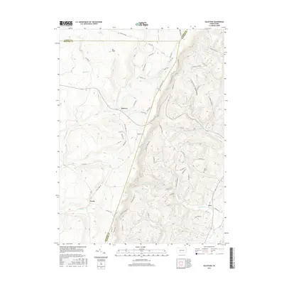
2016 Map of Ogletown
USGS Topo · Published 2016About this map
Pot Ridge and its surrounding heights dominate this corner of the Alleghenies, where the borders of Somerset, Bedford, and Cambria counties converge. The settlement at Ogletown serves as a central point for a network of forest roads and hiking paths, including the Buffalo Trail and Co Line Trail, which traverse the high ground between Babcock Cr and Clear Shade Cr. To the south, the terrain descends toward the small communities of Crumb and Ryot, the latter situated near the confluence of Ryot Run and Dunning Cr. Local history and genealogy interest is anchored by the Mock Church Cem in the eastern hills. The landscape is dotted with small mountain reservoirs like Pine Lake and Lake Rene, reflecting a land defined by its high-altitude headwaters and the historic path of the Old Bedford Pike winding across the northern ridges.
Find a feature on this map
72 named features on this map. Tap any name to fly to it.
Don’t see what you’re looking for? This feature index may not catch every label — zoom into the map to look around manually.
Map Details
Editions of this 2016 Ogletown Map
This is the sole edition of this map. No revisions or reprints were ever made.
Other maps of this area

1902 · Ebensburg
USGS Topo · 1:62,500

1904 · Ebensburg
USGS Topo · 1:62,500

1904 · Johnstown
USGS Topo · 1:62,500

1907 · Johnstown
USGS Topo · 1:62,500

1908 · Bedford
USGS Topo · 1:62,500

1910 · Bedford
USGS Topo · 1:62,500

1914 · Windber
USGS Topo · 1:62,500

1916 · Windber
USGS Topo · 1:62,500

1944 · Windber
USGS Topo · 1:62,500

1953 · Pittsburgh
USGS Topo · 1:250,000
Featured Places
- Napier Township, PA
- Shade Township, PA
- Crumb, Shade Township
- Ryot, West Saint Clair Township
- West Saint Clair Township, PA