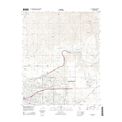
2015 Map of Oil Center
USGS Topo · Published 2015About this map
Bakersfield and its surrounding petroleum landscapes are documented in this detailed 2015 study, revealing the dense urban-industrial grid of East Bakersfield and the Central Valley. The map highlights the significant infrastructure of the region's energy history, including named industrial hubs like Oil Center, Oil City, and Maltha. These settlements are situated amidst a complex terrain of gulches and hills, such as Sacramento Gulch and Ant Hill.
Find a feature on this map
33 named features on this map. Tap any name to fly to it.
Don’t see what you’re looking for? This feature index may not catch every label — zoom into the map to look around manually.
Map Details
Editions of this 2015 Oil Center Map
This is the sole edition of this map. No revisions or reprints were ever made.
Other maps of this area

1906 · Bakersfield
USGS Topo · 1:62,500

1910 · Buena Vista Lake
USGS Topo · 1:125,000

1912 · Buena Vista Lake
USGS Topo · 1:125,000

1914 · Caliente
USGS Topo · 1:125,000

1929 · Fairfax School
USGS Topo · 1:31,680

1930 · Oildale
USGS Topo · 1:31,680

1931 · Edison
USGS Topo · 1:31,680

1932 · North of Oildale
USGS Topo · 1:31,680

1932 · Fairfax School
USGS Topo · 1:31,680
1932 · Gosford
USGS Topo · 1:31,680