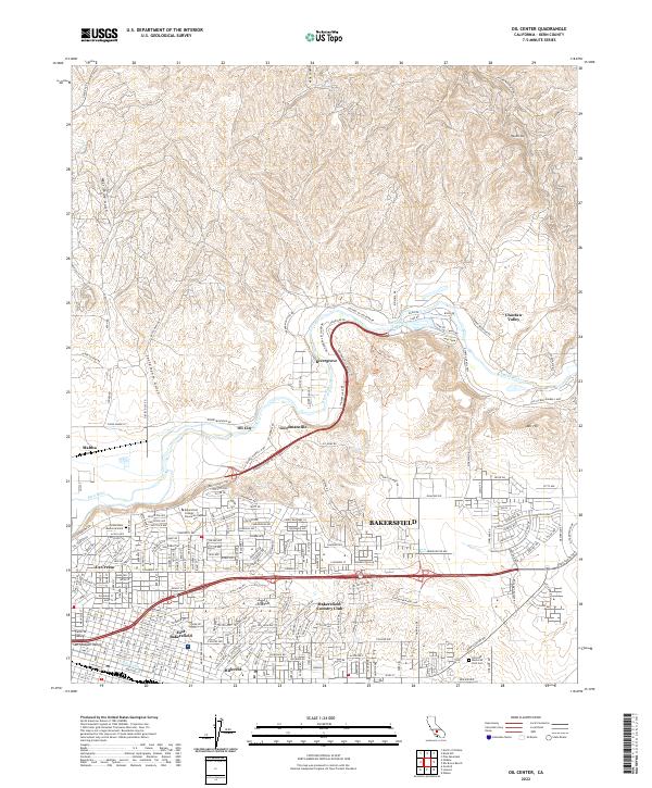
2022 Map of Oil Center
USGS Topo · Published 2022About this map
The Kern River valley defines this landscape northeast of Bakersfield, where steep gulches and canyons descend from the northern heights into the urbanizing plains. This industrial and residential corridor is marked by the legacy of the oil industry, with settlements like Oil City, Goodmanville, and Maltha situated along the slopes. The terrain is deeply incised by West Shore Gulch and Sacramento Gulch, while recreational and institutional hubs provide a contrast to the industrial zones. Hart Park and its Hart Park Lake sit along the riverbanks, overlooked by the Uplands of the Kern Dr. To the south, the city's growth is visible in neighborhoods like East Bakersfield, La Cresta, and Hillcrest, anchored by landmarks such as Bakersfield College Panorama Campus and the Bakersfield Country Club.
Find a feature on this map
165 named features on this map. Tap any name to fly to it.
Don’t see what you’re looking for? This feature index may not catch every label — zoom into the map to look around manually.
Map Details
Editions of this 2022 Oil Center Map
This is the sole edition of this map. No revisions or reprints were ever made.
Other maps of this area

1906 · Bakersfield
USGS Topo · 1:62,500

1910 · Buena Vista Lake
USGS Topo · 1:125,000

1912 · Buena Vista Lake
USGS Topo · 1:125,000

1914 · Caliente
USGS Topo · 1:125,000

1929 · Fairfax School
USGS Topo · 1:31,680

1930 · Oildale
USGS Topo · 1:31,680

1931 · Edison
USGS Topo · 1:31,680

1932 · North of Oildale
USGS Topo · 1:31,680

1932 · Fairfax School
USGS Topo · 1:31,680
1932 · Gosford
USGS Topo · 1:31,680