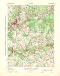
1943 Map of Oil City
USGS Topo · Published 1944About this map
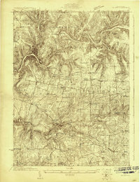
Oil City serves as the industrial heart of this 1940s landscape, where the confluence of Oil Creek and the Allegheny River shaped a dense network of extraction and transport. The map documents the enduring infrastructure of the Pennsylvania oil region, showing numerous Oil Well sites and the Clapp Lease alongside the tracks of the Pennsylvania Railroad and New York Central Railroad. Moving away from the river corridors, the terrain transitions into a patchwork of rural townships like Cornplanter and President, marked by an exceptionally high density of local institutions. Small settlements such as Rouseville, Reno, and Salina are anchors for the surrounding countryside, which is dotted with one-room schoolhouses like Foster Hill Sch and Maple Hollow Sch, and community landmarks including Monarch Park and the Splane Memorial Field. This survey captures the region just as the mid-century economy remained deeply tied to its namesake resource.
Find a feature on this map
112 named features on this map. Tap any name to fly to it.
Don’t see what you’re looking for? This feature index may not catch every label — zoom into the map to look around manually.
Map Details
Editions of this 1943 Oil City Map
This is the sole edition of this map. No revisions or reprints were ever made.
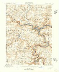
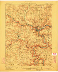
Other maps of this area

1906 · Clarion
USGS Topo · 1:62,500

1907 · Clarion
USGS Topo · 1:62,500

1907 · Foxburg
USGS Topo · 1:62,500

1908 · Foxburg
USGS Topo · 1:62,500
1909 · Franklin
USGS Topo · 1:62,500

1910 · Hilliards
USGS Topo · 1:62,500
1911 · Franklin
USGS Topo · 1:62,500
1912 · Hilliards
USGS Topo · 1:62,500
1922 · Oil City
USGS Topo · 1:48,000

1922 · Tionesta
USGS Topo · 1:62,500