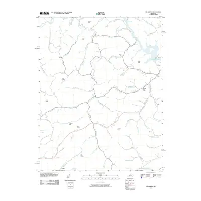
2010 Map of Oil Springs
USGS Topo · Published 2010About this map
Manila Post Office and the surrounding homesteads define the social geography of this rural Johnson County landscape in 2010. The topography is marked by a series of prominent peaks, including Stuffley Knob, Potato Knob, and Cane Knob, which channel development along narrow creek valleys. Settlement patterns follow the winding paths of Little Paint Creek and Barnetts Creek, where family legacies are preserved in numerous hilltop burial grounds like Conley Cemetery and the Tackett Cemetery.
Find a feature on this map
84 named features on this map. Tap any name to fly to it.
Don’t see what you’re looking for? This feature index may not catch every label — zoom into the map to look around manually.
Map Details
Editions of this 2010 Oil Springs Map
This is the sole edition of this map. No revisions or reprints were ever made.
Other maps of this area

1886 · Prestonsburg
USGS Topo · 1:125,000

1889 · Salyersville
USGS Topo · 1:125,000

1891 · Salyersville
USGS Topo · 1:125,000

1892 · Prestonsburg
USGS Topo · 1:125,000

1899 · Salyersville
USGS Topo · 1:125,000

1915 · Paintsville
USGS Topo · 1:48,000

1915 · Prestonsburg
USGS Topo · 1:62,500

1917 · Paintsville
USGS Topo · 1:62,500

1918 · Prestonsburg
USGS Topo · 1:62,500
1951 · Dingus
USGS Topo · 1:24,000