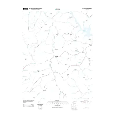
2013 Map of Oil Springs
USGS Topo · Published 2013About this map
Oil Springs sits at the center of this Johnson County landscape, where the headwaters of Little Paint Cr and Salyer Fork meet. The terrain is defined by a dense network of narrow branches and hollows, including Caudill Frk and Moccasin Br, which wind between significant elevations like Potato Knob and Stuffley Knob. This modern survey illustrates the persistent rural settlement patterns of Eastern Kentucky, with residences and family sites concentrated along the valley floors and narrow ridgeline roads. Genealogists will find numerous family burial grounds documented, such as Frank Prater Cem, Adams Cem, and the Tackett Cem. To the northeast, the map shows the reaching fingers of Paintsville Lake, while smaller communities like Manila and Painters Lick are connected by a web of local routes including the State Road Fork and Barnetts Creek Rd.
Find a feature on this map
114 named features on this map. Tap any name to fly to it.
Don’t see what you’re looking for? This feature index may not catch every label — zoom into the map to look around manually.
Map Details
Editions of this 2013 Oil Springs Map
This is the sole edition of this map. No revisions or reprints were ever made.
Other maps of this area

1886 · Prestonsburg
USGS Topo · 1:125,000

1889 · Salyersville
USGS Topo · 1:125,000

1891 · Salyersville
USGS Topo · 1:125,000

1892 · Prestonsburg
USGS Topo · 1:125,000

1899 · Salyersville
USGS Topo · 1:125,000

1915 · Paintsville
USGS Topo · 1:48,000

1915 · Prestonsburg
USGS Topo · 1:62,500

1917 · Paintsville
USGS Topo · 1:62,500

1918 · Prestonsburg
USGS Topo · 1:62,500
1951 · Dingus
USGS Topo · 1:24,000