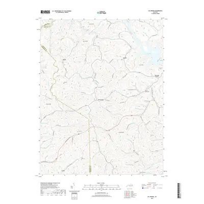
2019 Map of Oil Springs
USGS Topo · Published 2019About this map
Oil Springs lies at the heart of this Johnson County landscape, where the headwaters of numerous forks and branches carve deep into the plateau. The settlement patterns follow the winding paths of Little Paint Cr and Salyer Fork, with small communities like Hargis, Manila, and Asa marking the intersections of local life. For genealogists and family historians, the area is rich with family-named landmarks and resting places, including the Tackett Cem near Barnetts Creek and the Frank Prater Cem to the south. The terrain is defined by prominent elevations such as Potato Knob and Cane Knob, while the Marshal Early Bridge serves as a notable local landmark. The intricate road network, featuring routes like Rte 40 and Old Barnetts Creek Rd, reflects a history of transit through the narrow valleys of eastern Kentucky.
Find a feature on this map
106 named features on this map. Tap any name to fly to it.
Don’t see what you’re looking for? This feature index may not catch every label — zoom into the map to look around manually.
Map Details
Editions of this 2019 Oil Springs Map
This is the sole edition of this map. No revisions or reprints were ever made.
Other maps of this area

1886 · Prestonsburg
USGS Topo · 1:125,000

1889 · Salyersville
USGS Topo · 1:125,000

1891 · Salyersville
USGS Topo · 1:125,000

1892 · Prestonsburg
USGS Topo · 1:125,000

1899 · Salyersville
USGS Topo · 1:125,000

1915 · Paintsville
USGS Topo · 1:48,000

1915 · Prestonsburg
USGS Topo · 1:62,500

1917 · Paintsville
USGS Topo · 1:62,500

1918 · Prestonsburg
USGS Topo · 1:62,500
1951 · Dingus
USGS Topo · 1:24,000