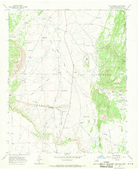
1966 Map of Ojo Hedionda
USGS Topo · Published 1970About this map
Archaeological remains and ranching infrastructure define this landscape south of Santa Fe in the late 1960s. Pre-contact history is marked by the Pueblo Chey Ruins and Pueblo Blanco Ruins, which sit among the drainages of Arroyo de la Jara and Cañada del Medio. These sites indicate long-term habitation in a region where water management was later adapted for cattle ranching, as evidenced by an extensive network of specialized water sources such as the La Jara Hogback Well, Little Jara Windmill, and Virginia Piña Well.
Find a feature on this map
40 named features on this map. Tap any name to fly to it.
Don’t see what you’re looking for? This feature index may not catch every label — zoom into the map to look around manually.
Map Details
Editions of this 1966 Ojo Hedionda Map
2 editions found
Other maps of this area

1892 · San Pedro
USGS Topo · 1:125,000

1894 · Lamy
USGS Topo · 1:125,000

1954 · Santa Fe
USGS Topo · 1:250,000

1956 · Edgewood
USGS Topo · 1:62,500

1958 · Santa Fe
USGS Topo · 1:250,000

1958 · Albuquerque
USGS Topo · 1:250,000

1960 · Stanley
USGS Topo · 1:62,500

1961 · Madrid
USGS Topo · 1:62,500

1962 · Albuquerque
USGS Topo · 1:250,000
1963 · Albuquerque
USGS Topo · 1:250,000