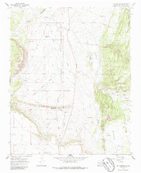
1966 Map of Ojo Hedionda
USGS Topo · Published 1986About this map
Ancient settlements and ephemeral water sources define this high-desert landscape in Santa Fe County. The presence of the Pueblo Blanco Ruins and Pueblo Chey Ruins indicates a long history of human habitation prior to modern ranching efforts. A remnant Old Railroad Grade cuts through the terrain, marking a former transportation corridor that once connected these arid reaches.
Find a feature on this map
41 named features on this map. Tap any name to fly to it.
Don’t see what you’re looking for? This feature index may not catch every label — zoom into the map to look around manually.
Map Details
Editions of this 1966 Ojo Hedionda Map
2 editions found
Other maps of this area

1892 · San Pedro
USGS Topo · 1:125,000

1894 · Lamy
USGS Topo · 1:125,000

1954 · Santa Fe
USGS Topo · 1:250,000

1956 · Edgewood
USGS Topo · 1:62,500

1958 · Santa Fe
USGS Topo · 1:250,000

1958 · Albuquerque
USGS Topo · 1:250,000

1960 · Stanley
USGS Topo · 1:62,500

1961 · Madrid
USGS Topo · 1:62,500

1962 · Albuquerque
USGS Topo · 1:250,000
1963 · Albuquerque
USGS Topo · 1:250,000