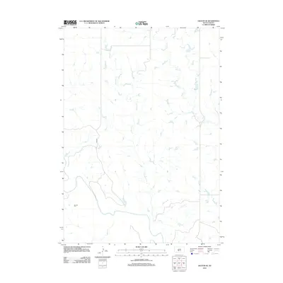
2012 Map of Okaton SE
USGS Topo · Published 2012About this map
The White River winds through this section of Mellette County, defining the drainage patterns of a landscape carved by several significant tributaries. In the early 21st century, this area of South Dakota remains primarily defined by its watercourses, including O'Donald Cr, Ash Cr, and Horse Cr, which spider through the prairie terrain. For those researching local family history, the Barnette Cem stands as a primary landmark on the southern banks of the river, while Co RD 52a provides one of the few improved routes through the region. The map reveals the sparse settlement patterns typical of the Great Plains, where natural features like Butch Cr and the river valley dictate the placement of rural infrastructure and burial grounds.
Find a feature on this map
7 named features on this map. Tap any name to fly to it.
Don’t see what you’re looking for? This feature index may not catch every label — zoom into the map to look around manually.
Map Details
Editions of this 2012 Okaton SE Map
This is the sole edition of this map. No revisions or reprints were ever made.
Other maps of this area

1951 · Okaton SW
USGS Topo · 1:24,000

1951 · Westover
USGS Topo · 1:24,000

1951 · Murdo SW
USGS Topo · 1:24,000

1951 · Murdo 3 NW
USGS Topo · 1:24,000

1951 · Murdo 3 NE
USGS Topo · 1:24,000

1951 · Okaton SE
USGS Topo · 1:24,000

1955 · Martin
USGS Topo · 1:250,000

1958 · Martin
USGS Topo · 1:250,000

1972 · Murdo
USGS Topo · 1:24,000

1972 · Okaton
USGS Topo · 1:24,000