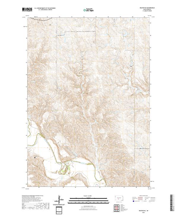
2021 Map of Okaton SE
USGS Topo · Published 2021About this map
The White River carves a deep valley across the landscape of south-central South Dakota, marking the dividing line for Jones Co and Mellette Co. This terrain is defined by a dense network of drainages, where Horse Cr and O'Donald Cr feed into the larger river system. The settlement pattern is sparse, reflecting the vast ranching traditions of the Great Plains. Cultural landmarks include the Barnette Cem and local thoroughfares such as Lerdahl Pl and Larson Pl. The map provides a look at the section lines and township divisions that govern this rural area, illustrating how local roads like Co Rd 52a navigate the breaks and gullies leading down to the riverbanks of Ash Cr and Butch Cr.
Find a feature on this map
20 named features on this map. Tap any name to fly to it.
Don’t see what you’re looking for? This feature index may not catch every label — zoom into the map to look around manually.
Map Details
Editions of this 2021 Okaton SE Map
This is the sole edition of this map. No revisions or reprints were ever made.
Other maps of this area

1951 · Okaton SW
USGS Topo · 1:24,000

1951 · Westover
USGS Topo · 1:24,000

1951 · Murdo SW
USGS Topo · 1:24,000

1951 · Murdo 3 NW
USGS Topo · 1:24,000

1951 · Murdo 3 NE
USGS Topo · 1:24,000

1951 · Okaton SE
USGS Topo · 1:24,000

1955 · Martin
USGS Topo · 1:250,000

1958 · Martin
USGS Topo · 1:250,000

1972 · Murdo
USGS Topo · 1:24,000

1972 · Okaton
USGS Topo · 1:24,000