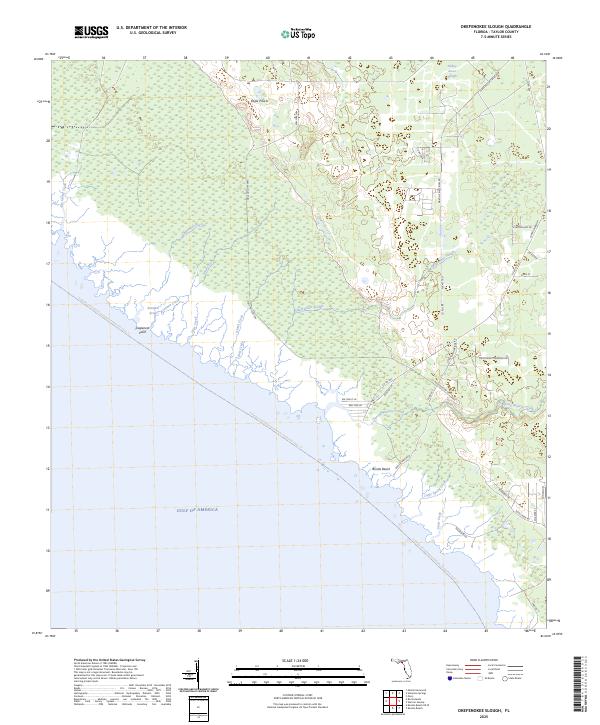
2025 Map of Okefenokee Slough
USGS Topo · Published 2025About this map
Okefenokee Slough and Turkey Roost Slough dominate this low-lying coastal landscape where the Florida Gulf Coast meets a complex network of freshwater drainages. Along the shoreline, the small community of Bonita Beach sits near the mouth of Spring Warrior Creek, surrounded by numerous tidal outlets like Island Creek and Holy Creek. The terrain transitions from the salt-influenced Eaglenest Point to interior landscapes such as Eagle Prairie, defined by natural features like Wallow Spr and Mule Hollow Spr. This coastal environment is part of the Florida Circumnavigational Paddling Trail Trl, emphasizing the area's importance for water-based navigation. The map detail highlights how the local road network, including Martins Electrical Rd and Boneta Beach Rd, navigates through the intricate wetlands to reach the edge of the Gulf of America.
Find a feature on this map
41 named features on this map. Tap any name to fly to it.
Don’t see what you’re looking for? This feature index may not catch every label — zoom into the map to look around manually.
Map Details
Editions of this 2025 Okefenokee Slough Map
This is the sole edition of this map. No revisions or reprints were ever made.
Other maps of this area

1954 · Warrior Swamp
USGS Topo · 1:24,000

1954 · Hampton Springs
USGS Topo · 1:24,000

1954 · Keaton Beach
USGS Topo · 1:24,000

1954 · Okefenokee Slough
USGS Topo · 1:24,000

1954 · Gainesville
USGS Topo · 1:250,000

1954 · Valdosta
USGS Topo · 1:250,000

1955 · Perry
USGS Topo · 1:24,000

1955 · Rock Islands
USGS Topo · 1:24,000

1955 · Manlin Hammock
USGS Topo · 1:24,000
1956 · Hampton Springs
USGS Topo · 1:25,000