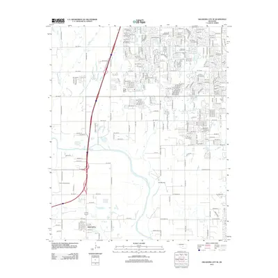
2012 Map of Oklahoma City SE
USGS Topo · Published 2012About this map
The Canadian River and its expansive Ten Mile Flat bottomlands dominate the southern half of this landscape, separating the residential development of the city from the settlement of Newcastle. By the early 2010s, suburban expansion from the north and east pressed toward the riverbanks, reaching the edge of Resthaven Gardens Cem and surrounding Shadow Lake. The map reveals a transition from dense urban grids to more open rural sections, particularly near Odom's Roost Airport and along the winding courses of Lost Cr and Boggy Cr. Cultural and educational landmarks are prominent, including the campus of Mid - America Christian Univ and several local burial grounds like Moore Cem and Emmanuel Cem. This survey documents a specific moment of urban growth where modern transit corridors like S MacArthur Blvd and S Portland Ave intersect with the traditional hydrology of the river valley.
Find a feature on this map
224 named features on this map. Tap any name to fly to it.
Don’t see what you’re looking for? This feature index may not catch every label — zoom into the map to look around manually.
Map Details
Editions of this 2012 Oklahoma City SE Map
This is the sole edition of this map. No revisions or reprints were ever made.
Other maps of this area

1892 · Moore
USGS Topo · 1:62,500

1893 · Norman
USGS Topo · 1:62,500

1893 · Oklahoma City
USGS Topo · 1:62,500

1898 · Purcell
USGS Topo · 1:125,000

1904 · Chickasha
USGS Topo · 1:125,000

1925 · Norman NO 2
USGS Topo · 1:24,000

1934 · Crutcho Creek
USGS Topo · 1:24,000

1934 · Moore
USGS Topo · 1:62,500

1936 · Norman
USGS Topo · 1:62,500

1938 · Moore
USGS Topo · 1:62,500