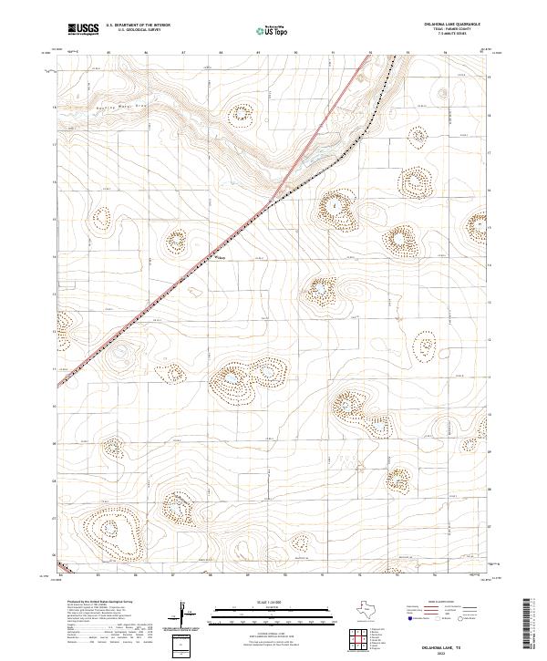
2022 Map of Oklahoma Lane
USGS Topo · Published 2022About this map
Wilsey sits as a central point of reference in this High Plains landscape of Parmer County, where the geometric grid of agricultural roads defines the human geography. The terrain is marked by the subtle depressions of ephemeral watercourses, most notably Running Water Draw in the northwest and Progress Draw further south. These seasonal drainage patterns provide the only deviation from the relentless surveyor's grid that segments the land into large square parcels. A network of secondary routes and farm-to-market roads, including FM 2396 and FM 3333, connects these rural reaches. This map illustrates the highly organized agricultural infrastructure of the Texas Panhandle, showing how transportation corridors like Ranch Rd 1731 and Ranch Rd 145 integrate this remote farming region with the broader state transit system.
Find a feature on this map
22 named features on this map. Tap any name to fly to it.
Don’t see what you’re looking for? This feature index may not catch every label — zoom into the map to look around manually.
Map Details
Editions of this 2022 Oklahoma Lane Map
This is the sole edition of this map. No revisions or reprints were ever made.
Other maps of this area

1954 · Clovis
USGS Topo · 1:250,000

1957 · Clovis
USGS Topo · 1:62,500

1957 · Pleasant Hill
USGS Topo · 1:62,500

1958 · Clovis
USGS Topo · 1:250,000

1963 · Lariat
USGS Topo · 1:24,000

1963 · Oklahoma Lane
USGS Topo · 1:24,000

1963 · Lariat NE
USGS Topo · 1:24,000

1963 · Progress
USGS Topo · 1:24,000

1965 · Bovina
USGS Topo · 1:24,000

1965 · Parmerton
USGS Topo · 1:24,000