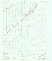
1963 Map of Oklahoma Lane
USGS Topo · Published 1981About this map
Oklahoma Lane and the agricultural landscape of Parmer County take center stage in this 1963 survey, updated with revisions from the late 1970s. The terrain is defined by the subtle drainage patterns of Running Water Draw and Progress Draw, which cut across the high plains. The expansion of industrial ranching is evident through the inclusion of a large Feedlot along the northern reaches of the Santa Fe and Panhandle railroad line. This transportation corridor serves as the primary axis for the region, connecting the small settlement of Oklahoma Lane to the broader rail network. Notable for its high density of wells, the map reflects the critical importance of the High Plains Underground Water Conservation District No. 1 in sustaining the local economy. From the small Roadside Park to the local Pit, the sheet records the functional infrastructure of a rural Texas community during a period of significant groundwater development.
Find a feature on this map
7 named features on this map. Tap any name to fly to it.
Don’t see what you’re looking for? This feature index may not catch every label — zoom into the map to look around manually.
Map Details
Editions of this 1963 Oklahoma Lane Map
2 editions found
Other maps of this area

1954 · Clovis
USGS Topo · 1:250,000

1957 · Clovis
USGS Topo · 1:62,500

1957 · Pleasant Hill
USGS Topo · 1:62,500

1958 · Clovis
USGS Topo · 1:250,000

1963 · Lariat
USGS Topo · 1:24,000

1963 · Oklahoma Lane
USGS Topo · 1:24,000

1963 · Lariat NE
USGS Topo · 1:24,000

1963 · Progress
USGS Topo · 1:24,000

1965 · Bovina
USGS Topo · 1:24,000

1965 · Parmerton
USGS Topo · 1:24,000