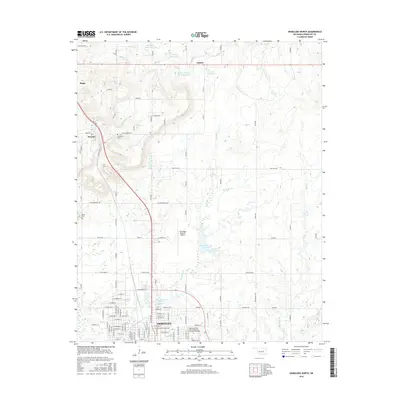
2016 Map of Okmulgee North
USGS Topo · Published 2016About this map
Okmulgee and its northern outskirts are the focal point of this 2016 survey, showcasing the modern infrastructure and academic presence of the Oklahoma State Univ Institute of Technology Okmulgee. The landscape is characterized by a sophisticated water management system, including the Okmulgee Creek Site 2 Reservoir and Okmulgee Cr Site 1 Reservoir, which sit amidst the drainages of Okmulgee Cr and Snake Cr.
Find a feature on this map
65 named features on this map. Tap any name to fly to it.
Don’t see what you’re looking for? This feature index may not catch every label — zoom into the map to look around manually.
Map Details
Editions of this 2016 Okmulgee North Map
This is the sole edition of this map. No revisions or reprints were ever made.
Other maps of this area

1896 · Okmulgee
USGS Topo · 1:125,000

1900 · Okmulgee
USGS Topo · 1:125,000

1901 · Nuyaka
USGS Topo · 1:125,000

1914 · Kiefer
USGS Topo · 1:62,500

1916 · Kiefer
USGS Topo · 1:62,500

1946 · Fort Smith
USGS Topo · 1:250,000

1954 · Oklahoma City
USGS Topo · 1:250,000

1957 · Oklahoma City
USGS Topo · 1:250,000

1963 · Oklahoma City
USGS Topo · 1:250,000

1965 · Fort Smith
USGS Topo · 1:250,000