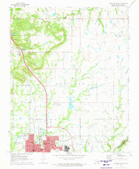
1971 Map of Okmulgee North
USGS Topo · Published 1973About this map
The city of Okmulgee dominates the southern reaches of this survey, shown at a time of significant educational and industrial activity. The campus of Oklahoma State Tech is clearly defined near the city center, while the St Louis and San Francisco railroad lines and a refinery underscore the local economy of the early 1970s. The landscape north of the city is a patchwork of rural homesteads and spiritual hubs, including the Natura Mission and several historically significant churches like Tallahassee Ch and New Town Ch. Numerous oil wells dot the terrain of Hamilton and Natura, revealing the extensive petroleum infrastructure threading through the Oklahoma countryside. Smaller communities such as Preston and Beggs appear along the rail corridors, flanked by landmarks like Jerusalem Cem and the waters of Snake Creek.
Find a feature on this map
35 named features on this map. Tap any name to fly to it.
Don’t see what you’re looking for? This feature index may not catch every label — zoom into the map to look around manually.
Map Details
Editions of this 1971 Okmulgee North Map
This is the sole edition of this map. No revisions or reprints were ever made.
Other maps of this area

1896 · Okmulgee
USGS Topo · 1:125,000

1900 · Okmulgee
USGS Topo · 1:125,000

1901 · Nuyaka
USGS Topo · 1:125,000

1914 · Kiefer
USGS Topo · 1:62,500

1916 · Kiefer
USGS Topo · 1:62,500

1946 · Fort Smith
USGS Topo · 1:250,000

1954 · Oklahoma City
USGS Topo · 1:250,000

1957 · Oklahoma City
USGS Topo · 1:250,000

1963 · Oklahoma City
USGS Topo · 1:250,000

1965 · Fort Smith
USGS Topo · 1:250,000