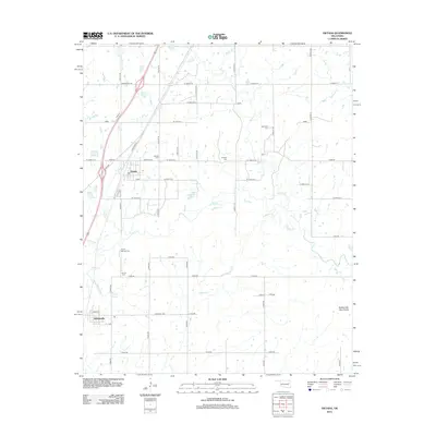
2012 Map of Oktaha
USGS Topo · Published 2012About this map
Oktaha and Rentiesville serve as the primary hubs for this portion of Muskogee County, where the landscape is defined by a dense network of country roads and low-lying creek drainage. The area is notable for its numerous burial sites, including Oktaha Cem, Honey Springs Cem, and Grayson Cem, which offer significant value for genealogical research in this historic Oklahoma region. Waterways like Dirty Cr and Timberly Cr meander toward the Rattlesnake Mountains in the southeast corner. The presence of Honey Springs and its namesake branch provides a direct link to the local terrain's natural history. Transport is anchored by the corridor along N Railroad St and Wainwright RD, reflecting a rural development pattern that persists into the early 21st century.
Find a feature on this map
38 named features on this map. Tap any name to fly to it.
Don’t see what you’re looking for? This feature index may not catch every label — zoom into the map to look around manually.
Map Details
Editions of this 2012 Oktaha Map
This is the sole edition of this map. No revisions or reprints were ever made.
Other maps of this area

1896 · Okmulgee
USGS Topo · 1:125,000

1900 · Sansbois
USGS Topo · 1:125,000

1900 · Canadian
USGS Topo · 1:125,000

1900 · Okmulgee
USGS Topo · 1:125,000

1901 · Muscogee
USGS Topo · 1:125,000

1905 · Muscogee
USGS Topo · 1:125,000

1909 · Sans Bois
USGS Topo · 1:125,000

1911 · Sansbois
USGS Topo · 1:125,000

1946 · Fort Smith
USGS Topo · 1:250,000

1948 · Keefeton
USGS Topo · 1:62,500