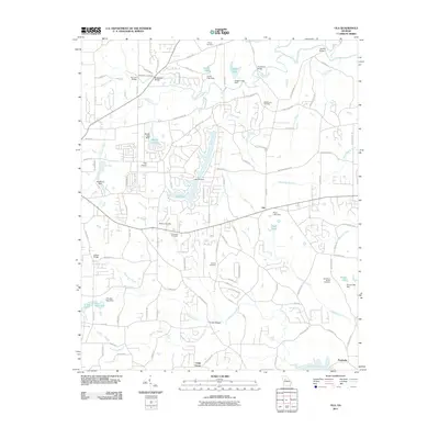
2011 Map of Ola
USGS Topo · Published 2011About this map
Ola serves as the central hub of this Georgia landscape, where rural residential development began to interface with the county's established agricultural character. The terrain is defined by a dense network of tributaries including Tussahaw Creek, Walnut Creek, and Peeksville Creek, many of which have been dammed to create local landmarks like Boyds Lake and Lake Dow. Genealogists will find a wealth of family history preserved in numerous burial grounds across the quadrangle, from the Old Sharon Cemetery in the north to the Old Mount Bethel Cemetery near the eastern edge. This 2011 survey captures the area just as suburban expansion moved into the reaches of Peeksville and Unity Grove, while still maintaining its small-town infrastructure, exemplified by the local Zips Airport and historic crossings like Double Bridges and Butler Bridge.
Find a feature on this map
112 named features on this map. Tap any name to fly to it.
Don’t see what you’re looking for? This feature index may not catch every label — zoom into the map to look around manually.
Map Details
Editions of this 2011 Ola Map
This is the sole edition of this map. No revisions or reprints were ever made.
Other maps of this area

1888 · Atlanta
USGS Topo · 1:125,000

1890 · Atlanta
USGS Topo · 1:125,000

1892 · Atlanta
USGS Topo · 1:125,000

1895 · Atlanta
USGS Topo · 1:125,000

1896 · Monroe
USGS Topo · 1:125,000

1953 · Atlanta
USGS Topo · 1:250,000

1953 · Athens
USGS Topo · 1:250,000

1957 · Atlanta
USGS Topo · 1:250,000

1958 · Athens
USGS Topo · 1:250,000

1958 · Atlanta
USGS Topo · 1:250,000