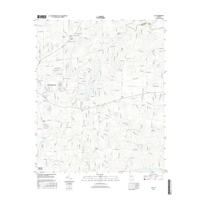
2017 Map of Ola
USGS Topo · Published 2017About this map
McDonough and the surrounding Henry County landscape are defined by a complex network of residential growth and long-standing rural landmarks. The South River forms a significant northern boundary, while the interior is drained by waterways such as Walnut Creek, Peeksville Creek, and Tussahaw Creek. Local history is deeply embedded in the terrain, evidenced by numerous burial grounds including Antioch Cemetery, Old Mount Bethel Cemetery, and Harkness Cemetery. Elevated features like Charleston Ridge overlook a countryside increasingly marked by subdivisions and neighborhood roads such as Laurel Ridge Drive and Wynnfield Boulevard. Key crossings, including Butler Bridge and Air Line Bridge, link the established community of Ola to the western development near Locust Grove. The map details many small bodies of water like Lake Ola and Duggan Lake, reflecting the area's transition from open farmland to a more densely populated suburban-rural mix.
Find a feature on this map
221 named features on this map. Tap any name to fly to it.
Don’t see what you’re looking for? This feature index may not catch every label — zoom into the map to look around manually.
Map Details
Editions of this 2017 Ola Map
This is the sole edition of this map. No revisions or reprints were ever made.
Other maps of this area

1888 · Atlanta
USGS Topo · 1:125,000

1890 · Atlanta
USGS Topo · 1:125,000

1892 · Atlanta
USGS Topo · 1:125,000

1895 · Atlanta
USGS Topo · 1:125,000

1896 · Monroe
USGS Topo · 1:125,000

1953 · Atlanta
USGS Topo · 1:250,000

1953 · Athens
USGS Topo · 1:250,000

1957 · Atlanta
USGS Topo · 1:250,000

1958 · Athens
USGS Topo · 1:250,000

1958 · Atlanta
USGS Topo · 1:250,000