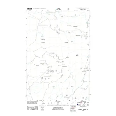
2011 Map of Old Baldy Mountain
USGS Topo · Published 2011About this map
Old Baldy Mountain and the high ridges of Madison County define a landscape defined by its deep mining heritage and rugged hydrology. At the start of the 21st century, the terrain is marked by an extensive network of mineral extraction sites, including the Eleanora Mines, the Giant Mine, and the uniquely named Tidal Wave Mine. The drainage patterns are dominated by Wisconsin Creek and Coal Creek, while engineering works like the Cornforth Ditch and Marsh Ditch illustrate the historical effort to redirect water across this high-elevation terrain. Settlement and transit are closely tied to the geography of the gulches, with Bear Gulch Rd and Rich Gulch Rd providing access to remote claims. From the shoreline of Smith Reservoir to the heights of Lava Mountain, the map documents a complex overlay of industrial prospect and natural preservation.
Find a feature on this map
83 named features on this map. Tap any name to fly to it.
Don’t see what you’re looking for? This feature index may not catch every label — zoom into the map to look around manually.
Map Details
Editions of this 2011 Old Baldy Mountain Map
This is the sole edition of this map. No revisions or reprints were ever made.
Other maps of this area

1893 · Dillon
USGS Topo · 1:250,000

1955 · Dillon
USGS Topo · 1:250,000

1957 · Dillon
USGS Topo · 1:250,000

1958 · Dillon
USGS Topo · 1:250,000

1960 · Twin Bridges
USGS Topo · 1:62,500

1960 · Waterloo
USGS Topo · 1:62,500

1962 · Dillon
USGS Topo · 1:250,000
1962 · Beaverhead Rock NE
USGS Topo · 1:24,000
1963 · Sheridan
USGS Topo · 1:24,000
1963 · Copper Mountain
USGS Topo · 1:24,000