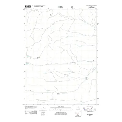
2011 Map of Old Canyon
USGS Topo · Published 2011About this map
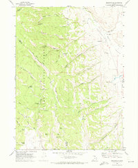
Otter Creek and its various branches dominate this high-elevation terrain in Rich County during the early 21st century. The landscape is defined by significant vertical relief, stretching from the water storage at Nick Reservoir and Lodgepole Reservoir up to prominent summits like Monument Peak and Twin Peaks. The complex drainage patterns of the Bear River Range are evident through features such as Middle Branch Otter Creek and South Branch Otter Creek, which carve through the high country alongside named landmarks like Long Ridge. This 2011 survey documents the hydrological and topographical details of the region, including numerous water sources essential for high-country livestock or wildlife, such as Clauson Spring, Keg Spring, and Willow Spring. The map traces primitive access routes including Otter Creek Rd and New Canyon Rd, providing a clear record of the area's infrastructure and natural landmarks in the modern era.
Find a feature on this map
22 named features on this map. Tap any name to fly to it.
Don’t see what you’re looking for? This feature index may not catch every label — zoom into the map to look around manually.
Map Details
Editions of this 2011 Old Canyon Map
This is the sole edition of this map. No revisions or reprints were ever made.
Other maps of this area

1912 · Randolph
USGS Topo · 1:125,000

1954 · Ogden
USGS Topo · 1:250,000

1958 · Ogden
USGS Topo · 1:250,000

1960 · Ogden
USGS Topo · 1:250,000

1968 · Randolph
USGS Topo · 1:24,000

1968 · Woodruff
USGS Topo · 1:24,000
1969 · Birch Creek Reservoirs
USGS Topo · 1:24,000
1969 · Curtis Ridge
USGS Topo · 1:24,000
1969 · Red Spur Mtn
USGS Topo · 1:24,000
1969 · Meadowville
USGS Topo · 1:24,000