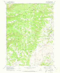
1969 Map of Curtis Ridge
USGS Topo · Published 1973About this map
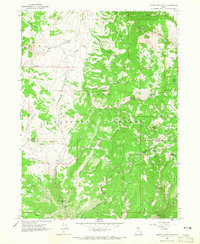
Cache National Forest dominates the high country along the border of Cache and Rich Counties, where a network of springs and drainage basins define the high-altitude landscape. This late-1960s survey documents a terrain shaped by ranching and resource management, anchored by the Hardware Ranch Trail (Pack) and various jeep trails. Water is the primary driver of activity here, evidenced by numerous named sources such as Little Crawford Spring, Blacksmith Spring, and the curiously named Bob Kiddys Hole Spring. To the west, Curtis Ridge stands above Mollens Hollow and Johnson Draw, while the eastern portion of the map transitions into the lower elevations of the Valley and the expansive Woodruff Park. Natural drainage features like Spencer Basin Sink and Valley Sink illustrate the karst-like geography of the region, where seasonal waters disappear into subterranean systems.
Find a feature on this map
59 named features on this map. Tap any name to fly to it.
Don’t see what you’re looking for? This feature index may not catch every label — zoom into the map to look around manually.
Map Details
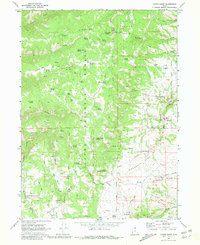
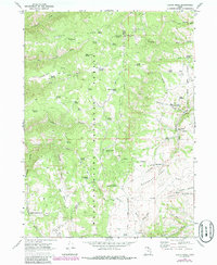
Editions of this 1969 Curtis Ridge Map
3 editions found
Other maps of this area

1912 · Randolph
USGS Topo · 1:125,000

1914 · Logan
USGS Topo · 1:125,000

1916 · Logan
USGS Topo · 1:125,000
1949 · Boulter Mts
USGS Topo · 1:24,000

1954 · Ogden
USGS Topo · 1:250,000

1958 · Ogden
USGS Topo · 1:250,000

1960 · Ogden
USGS Topo · 1:250,000
1964 · Monte Cristo PK
USGS Topo · 1:24,000

1968 · Dairy Ridge
USGS Topo · 1:24,000
1968 · Meachum Ridge
USGS Topo · 1:24,000