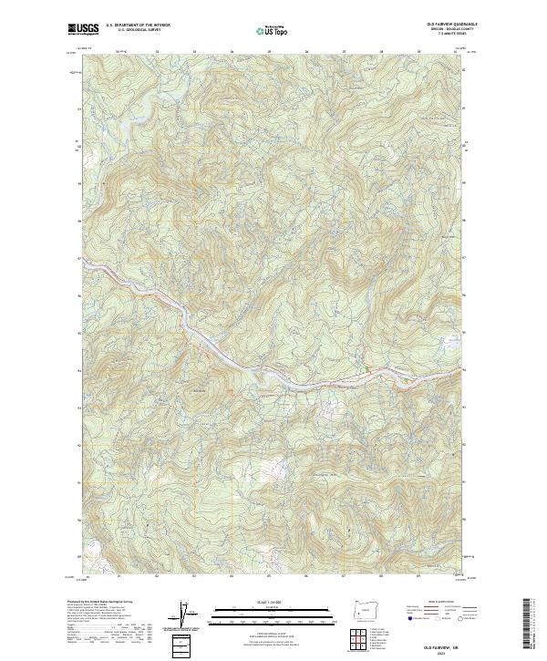
2023 Map of Old Fairview
USGS Topo · Published 2023About this map
North Umpqua Wild and Scenic River carves a deep valley through this Douglas County landscape, serving as the primary corridor for movement and recreation. The 2023 survey illustrates a complex network of Bureau of Land Management roads, such as BLM RD 22-0 and BLM RD 24-0, which provide access to timberlands and peaks like Old Fairview and Shivigny Mtn. Natural landmarks like Susan Creek Falls and the Lone Rock Highlands are connected by established routes including the North Umpqua Trl and Emerald Trl. The presence of industrial sites like Conley Quarry and a Gravel Pit along the river suggests an economy tied to resource extraction and road maintenance, while the Paris Reservoir on Cole Creek points to local water management in this heavily forested terrain.
Find a feature on this map
60 named features on this map. Tap any name to fly to it.
Don’t see what you’re looking for? This feature index may not catch every label — zoom into the map to look around manually.
Map Details
Editions of this 2023 Old Fairview Map
This is the sole edition of this map. No revisions or reprints were ever made.
Other maps of this area

1897 · Roseburg
USGS Topo · 1:125,000

1900 · Roseburg
USGS Topo · 1:125,000

1954 · Dixonville
USGS Topo · 1:62,500

1954 · Glide
USGS Topo · 1:62,500

1955 · Red Butte
USGS Topo · 1:62,500

1955 · Mace Mtn
USGS Topo · 1:62,500

1958 · Roseburg
USGS Topo · 1:250,000

1959 · Roseburg
USGS Topo · 1:250,000

1978 · Diamond Lake
USGS Topo · 1:100,000

1979 · Roseburg
USGS Topo · 1:100,000