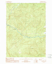
1989 Map of Old Fairview
USGS Topo · Published 1990About this map
The North Umpqua River carves a central path through this Douglas County landscape, serving as the primary corridor for development and recreation during the late 20th century. Along its banks, the Swiftwater County Park and Richard G Baker Memorial County Park mark dedicated public spaces, while the Susan Creek Recreation Site provides access to natural landmarks like Susan Creek Falls. Away from the river, the terrain is defined by sharp elevation changes, climbing toward Shivigny Mountain, Burnt Mountain, and the distinct Chimney Rock.
Find a feature on this map
37 named features on this map. Tap any name to fly to it.
Don’t see what you’re looking for? This feature index may not catch every label — zoom into the map to look around manually.
Map Details
Editions of this 1989 Old Fairview Map
This is the sole edition of this map. No revisions or reprints were ever made.
Other maps of this area

1897 · Roseburg
USGS Topo · 1:125,000

1900 · Roseburg
USGS Topo · 1:125,000

1954 · Dixonville
USGS Topo · 1:62,500

1954 · Glide
USGS Topo · 1:62,500

1955 · Red Butte
USGS Topo · 1:62,500

1955 · Mace Mtn
USGS Topo · 1:62,500

1958 · Roseburg
USGS Topo · 1:250,000

1959 · Roseburg
USGS Topo · 1:250,000

1978 · Diamond Lake
USGS Topo · 1:100,000

1979 · Roseburg
USGS Topo · 1:100,000