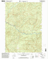
1997 Map of Old Fairview
USGS Topo · Published 2000About this map
The North Fork Umpqua River serves as the central artery for this Douglas County landscape, winding past a series of public riverfront lands and natural landmarks. The river corridor is punctuated by a network of recreation sites, including Swiftwater County Park and the Richard G Baker Memorial County Park. Further east, Smith Springs and the associated Smith Springs County Park mark a key gathering point along the water.
Find a feature on this map
30 named features on this map. Tap any name to fly to it.
Don’t see what you’re looking for? This feature index may not catch every label — zoom into the map to look around manually.
Map Details
Editions of this 1997 Old Fairview Map
This is the sole edition of this map. No revisions or reprints were ever made.
Other maps of this area

1897 · Roseburg
USGS Topo · 1:125,000

1900 · Roseburg
USGS Topo · 1:125,000

1954 · Dixonville
USGS Topo · 1:62,500

1954 · Glide
USGS Topo · 1:62,500

1955 · Red Butte
USGS Topo · 1:62,500

1955 · Mace Mtn
USGS Topo · 1:62,500

1958 · Roseburg
USGS Topo · 1:250,000

1959 · Roseburg
USGS Topo · 1:250,000

1978 · Diamond Lake
USGS Topo · 1:100,000

1979 · Roseburg
USGS Topo · 1:100,000