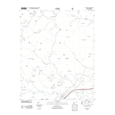
2011 Map of Old Fort
USGS Topo · Published 2011About this map
Old Fort sits at the foot of the Blue Ridge where the Catawba River and Swannanoa Creek drain the high mountain slopes. This 2011 survey details a landscape defined by the sharp transition from the valley floor to the Pisgah National Forest, including the famous Andrews Geyser and the Siloam Cemeteries to the east. The map tracks the complex hydrology of the region, from the headwaters of the South Toe River in the north to Mill Creek in the south, documenting the infrastructure of mountain life including the Camp Grier Dam and the Green Knob Lookout.
Find a feature on this map
101 named features on this map. Tap any name to fly to it.
Don’t see what you’re looking for? This feature index may not catch every label — zoom into the map to look around manually.
Map Details
Editions of this 2011 Old Fort Map
This is the sole edition of this map. No revisions or reprints were ever made.
Other maps of this area

1900 · Mount Mitchell
USGS Topo · 1:125,000

1902 · Mount Mitchell
USGS Topo · 1:125,000

1934 · Parts Of Celo And Black Brothers
USGS Topo · 1:24,000

1934 · Parts Of Old Fort and Montreat
USGS Topo · 1:24,000

1935 · Montreat
USGS Topo · 1:24,000

1935 · Black Brothers
USGS Topo · 1:24,000

1935 · Black Mountain
USGS Topo · 1:24,000

1941 · Black Mountain
USGS Topo · 1:24,000
1942 · Montreat
USGS Topo · 1:24,000
1943 · Black Mountain
USGS Topo · 1:24,000