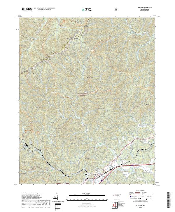
2022 Map of Old Fort
USGS Topo · Published 2022About this map
Old Fort sits at the base of the Blue Ridge Escarpment, where the Catawba River begins its eastward flow. This terrain is defined by the high-elevation Blue Ridge Parkway following the crests of Whiteside Ridge and Black Ridge along the Yancey and McDowell County line. The map highlights the transition from the steep, forested slopes of the Pisgah National Forest to the burgeoning valley floor. Historical local landmarks like Andrews Geyser and the Old Fort City Cemetery reflect the long human history of this rail-and-river gateway. Settlement patterns are concentrated along the State Road 1401 and East Main Street corridors, while the higher elevations are preserved with an extensive network of footpaths including the Mountains to Sea Trail and Heartbreak Ridge Trail.
Find a feature on this map
118 named features on this map. Tap any name to fly to it.
Don’t see what you’re looking for? This feature index may not catch every label — zoom into the map to look around manually.
Map Details
Editions of this 2022 Old Fort Map
This is the sole edition of this map. No revisions or reprints were ever made.
Other maps of this area

1900 · Mount Mitchell
USGS Topo · 1:125,000

1902 · Mount Mitchell
USGS Topo · 1:125,000

1934 · Parts Of Celo And Black Brothers
USGS Topo · 1:24,000

1934 · Parts Of Old Fort and Montreat
USGS Topo · 1:24,000

1935 · Montreat
USGS Topo · 1:24,000

1935 · Black Brothers
USGS Topo · 1:24,000

1935 · Black Mountain
USGS Topo · 1:24,000

1941 · Black Mountain
USGS Topo · 1:24,000
1942 · Montreat
USGS Topo · 1:24,000
1943 · Black Mountain
USGS Topo · 1:24,000