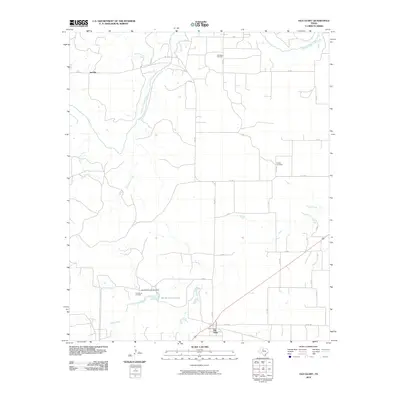
2010 Map of Old Glory
USGS Topo · Published 2010About this map
Old Glory stands as the primary settlement in this corner of Stonewall County, situated at the junction of several rural routes including Co RD 132. The landscape is defined by the winding course of the Salt Fork Brazos River, which is fed by numerous tributaries such as Wilfong Creek and Rockhouse Creek. The area's economic history is tied to the energy sector, evidenced by the Old Glory Oil Field in the north and the Pumphrey Oil Field to the southwest.
Find a feature on this map
32 named features on this map. Tap any name to fly to it.
Don’t see what you’re looking for? This feature index may not catch every label — zoom into the map to look around manually.
Map Details
Editions of this 2010 Old Glory Map
This is the sole edition of this map. No revisions or reprints were ever made.
Other maps of this area

1925 · Aspermont 4-a
USGS Topo · 1:48,000

1925 · Haskell 3-b
USGS Topo · 1:48,000

1931 · Aspermont
USGS Topo · 1:62,500

1954 · Lubbock
USGS Topo · 1:250,000

1954 · Wichita Falls
USGS Topo · 1:250,000

1958 · Wichita Falls
USGS Topo · 1:250,000

1962 · Kiowa Peak
USGS Topo · 1:24,000
1962 · Frog Mountain
USGS Topo · 1:24,000

1964 · Sagerton
USGS Topo · 1:24,000

1965 · Jud
USGS Topo · 1:24,000