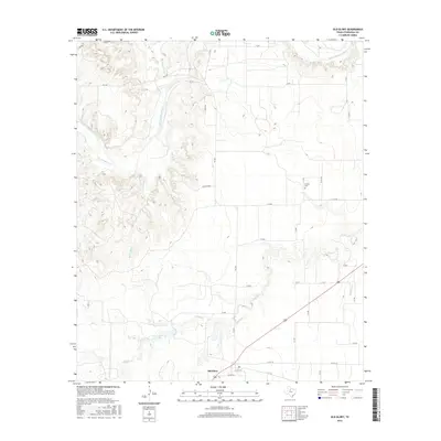
2016 Map of Old Glory
USGS Topo · Published 2016About this map
The settlement of Old Glory serves as the focal point of this 2016 survey, situated in the rangelands of Stonewall County. The landscape is defined by the winding course of the Salt Fork Brazos River, which carves through the northern portion of the quadrangle. Significant water features including Jay Pumphrey Lake and a network of seasonal drainages like Turkey Roost Cr and Rockhouse Cr illustrate the hydrological pattern of the region. Local history and genealogy interests are represented by the Hooker Cem, located near several county roads. The map documents a rural infrastructure where ranching life is evident through numerous named routes like FM 1835 and various private access points. The transition from the rugged drainage of Tonk Cr to the flatter plains highlights the varied terrain that has shaped settlement patterns and land use in this part of West Texas.
Find a feature on this map
36 named features on this map. Tap any name to fly to it.
Don’t see what you’re looking for? This feature index may not catch every label — zoom into the map to look around manually.
Map Details
Editions of this 2016 Old Glory Map
This is the sole edition of this map. No revisions or reprints were ever made.
Other maps of this area

1925 · Aspermont 4-a
USGS Topo · 1:48,000

1925 · Haskell 3-b
USGS Topo · 1:48,000

1931 · Aspermont
USGS Topo · 1:62,500

1954 · Lubbock
USGS Topo · 1:250,000

1954 · Wichita Falls
USGS Topo · 1:250,000

1958 · Wichita Falls
USGS Topo · 1:250,000

1962 · Kiowa Peak
USGS Topo · 1:24,000
1962 · Frog Mountain
USGS Topo · 1:24,000

1964 · Sagerton
USGS Topo · 1:24,000

1965 · Jud
USGS Topo · 1:24,000