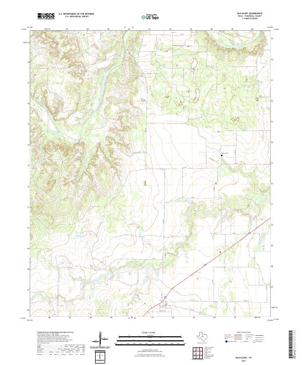
2022 Map of Old Glory
USGS Topo · Published 2022About this map
Salt Fork Brazos River cuts through the northern reaches of this West Texas terrain, carving a complex drainage system across the landscape. The geography is defined by a network of seasonal watercourses and creek beds, including Turkey Roost Cr and Rockhouse Cr, which flow toward the larger river basin. Evidence of early settlement and local family history is anchored by Hooker Cem in the eastern portion of the survey, providing a specific point of interest for genealogists tracking lineage in this part of Stonewall County. Modern infrastructure consists primarily of a grid of county roads and state routes, such as FM 1835 and Highway 380, which connect the rural holdings. The southern section is dominated by the meandering path of Tonk Creek, illustrating the hydraulic patterns that have shaped land use and ranching boundaries in the region for generations.
Find a feature on this map
37 named features on this map. Tap any name to fly to it.
Don’t see what you’re looking for? This feature index may not catch every label — zoom into the map to look around manually.
Map Details
Editions of this 2022 Old Glory Map
This is the sole edition of this map. No revisions or reprints were ever made.
Other maps of this area

1925 · Aspermont 4-a
USGS Topo · 1:48,000

1925 · Haskell 3-b
USGS Topo · 1:48,000

1931 · Aspermont
USGS Topo · 1:62,500

1954 · Lubbock
USGS Topo · 1:250,000

1954 · Wichita Falls
USGS Topo · 1:250,000

1958 · Wichita Falls
USGS Topo · 1:250,000

1962 · Kiowa Peak
USGS Topo · 1:24,000
1962 · Frog Mountain
USGS Topo · 1:24,000

1964 · Sagerton
USGS Topo · 1:24,000

1965 · Jud
USGS Topo · 1:24,000