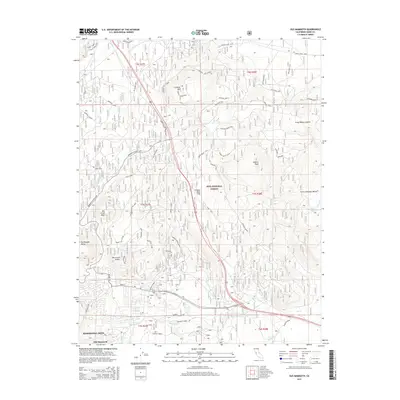
2015 Map of Old Mammoth
USGS Topo · Published 2015About this map
Mammoth Lakes and the historical site of Old Mammoth anchor the southwestern corner of this survey, set against the dramatic geology of the eastern Sierra. The landscape is defined by the massive Long Valley Caldera and volcanic features like Earthquake Dome and the Mammoth Knolls. This era shows a complex network of forest access and recreation routes within the Inyo National Forest, including the Mammoth Scenic Loop and various specialized paths like the Sawmill Gap Ski Loop. To the east, the terrain transitions into the high-altitude plains of Smokey Bear Flat and Little Antelope Valley, where Hot Cr and Little Hot Cr reveal the geothermal character of the region. Notable peaks such as Lookout Mtn and Gilbert Peak provide significant vertical relief over the Antelope Bench and its surrounding spurs.
Find a feature on this map
92 named features on this map. Tap any name to fly to it.
Don’t see what you’re looking for? This feature index may not catch every label — zoom into the map to look around manually.
Map Details
Editions of this 2015 Old Mammoth Map
This is the sole edition of this map. No revisions or reprints were ever made.
Other maps of this area

1901 · Mt. Lyell
USGS Topo · 1:125,000

1914 · Mt. Morrison
USGS Topo · 1:125,000

1947 · Mariposa
USGS Topo · 1:250,000

1948 · Mariposa
USGS Topo · 1:250,000

1953 · Mt. Morrison
USGS Topo · 1:62,500

1953 · Mono Craters
USGS Topo · 1:62,500

1953 · Devils Postpile
USGS Topo · 1:62,500

1957 · Mariposa
USGS Topo · 1:250,000

1962 · Cowtrack Mtn
USGS Topo · 1:62,500

1963 · Mariposa
USGS Topo · 1:250,000