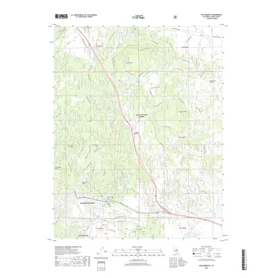
2018 Map of Old Mammoth
USGS Topo · Published 2018About this map
Mammoth Lakes serves as the focal point of this 2018 survey, documenting the modern footprint of this Sierra Nevada community. The map illustrates the transition from the concentrated development at Old Mammoth and Mill City to the surrounding protected lands of the Inyo National Forest. High-altitude geology is a defining characteristic, with the Long Valley Caldera and volcanic landmarks like Earthquake Dome and Lookout Mountain framing the topography. Geothermal and hydrologic features are prominent, including the headwaters of Hot Creek and Mammoth Creek. Cultural history is noted through recreation and utility sites such as the Old Shady Rest Campground and the Old CCC Camp, while an extensive network of forest roads like the Mammoth Scenic Loop and Antelope Springs Road provides access across the volcanic flats of Smokey Bear Flat.
Find a feature on this map
70 named features on this map. Tap any name to fly to it.
Don’t see what you’re looking for? This feature index may not catch every label — zoom into the map to look around manually.
Map Details
Editions of this 2018 Old Mammoth Map
This is the sole edition of this map. No revisions or reprints were ever made.
Other maps of this area

1901 · Mt. Lyell
USGS Topo · 1:125,000

1914 · Mt. Morrison
USGS Topo · 1:125,000

1947 · Mariposa
USGS Topo · 1:250,000

1948 · Mariposa
USGS Topo · 1:250,000

1953 · Mt. Morrison
USGS Topo · 1:62,500

1953 · Mono Craters
USGS Topo · 1:62,500

1953 · Devils Postpile
USGS Topo · 1:62,500

1957 · Mariposa
USGS Topo · 1:250,000

1962 · Cowtrack Mtn
USGS Topo · 1:62,500

1963 · Mariposa
USGS Topo · 1:250,000