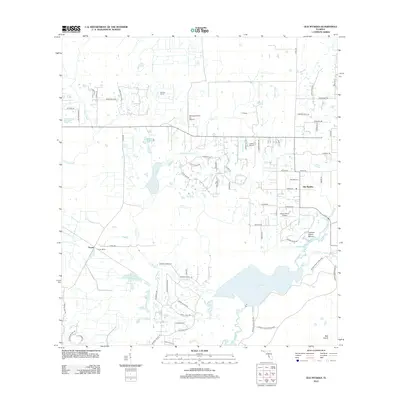
2012 Map of Old Myakka
USGS Topo · Published 2012About this map
Old Myakka serves as the focal point of this Sarasota County landscape, where the flatlands of Florida meet the wetlands of the Myakka River basin. The area is defined by a series of large agricultural holdings and ranches, including Hi Hat Ranch, Ox Bow Ranch, and T C Ranch. These expansive properties are interspersed with private aviation strips such as Hidden River Airport and Lowes Airport, reflecting a unique rural-residential character.
Find a feature on this map
71 named features on this map. Tap any name to fly to it.
Don’t see what you’re looking for? This feature index may not catch every label — zoom into the map to look around manually.
Map Details
Editions of this 2012 Old Myakka Map
This is the sole edition of this map. No revisions or reprints were ever made.
Other maps of this area

1943 · Laurel
USGS Topo · 1:24,000

1944 · Lower Myakka Lake
USGS Topo · 1:31,680

1944 · Verna
USGS Topo · 1:31,680

1944 · Laurel
USGS Topo · 1:31,680

1944 · Lorraine
USGS Topo · 1:31,680

1944 · Miakka
USGS Topo · 1:31,680

1947 · Bee Ridge
USGS Topo · 1:24,000

1956 · Myakka City
USGS Topo · 1:24,000

1956 · Myakka City NW
USGS Topo · 1:24,000

1956 · Murdock NW
USGS Topo · 1:24,000